29 ottobre 2008
Google Street View
esplorazione immersiva del territorio
interfaccia semplice ed intuitiva
_integrata con i servizi di Google Maps_
Come riutilizzare le immagini?
Come estrarre altre informazioni da quello che si vede?
_integrazione con QGIS_
I Termini di utilizzo sono restrittivi:
_Nessun uso "derivativo" del servizio_
Ci sono risorse non documentate
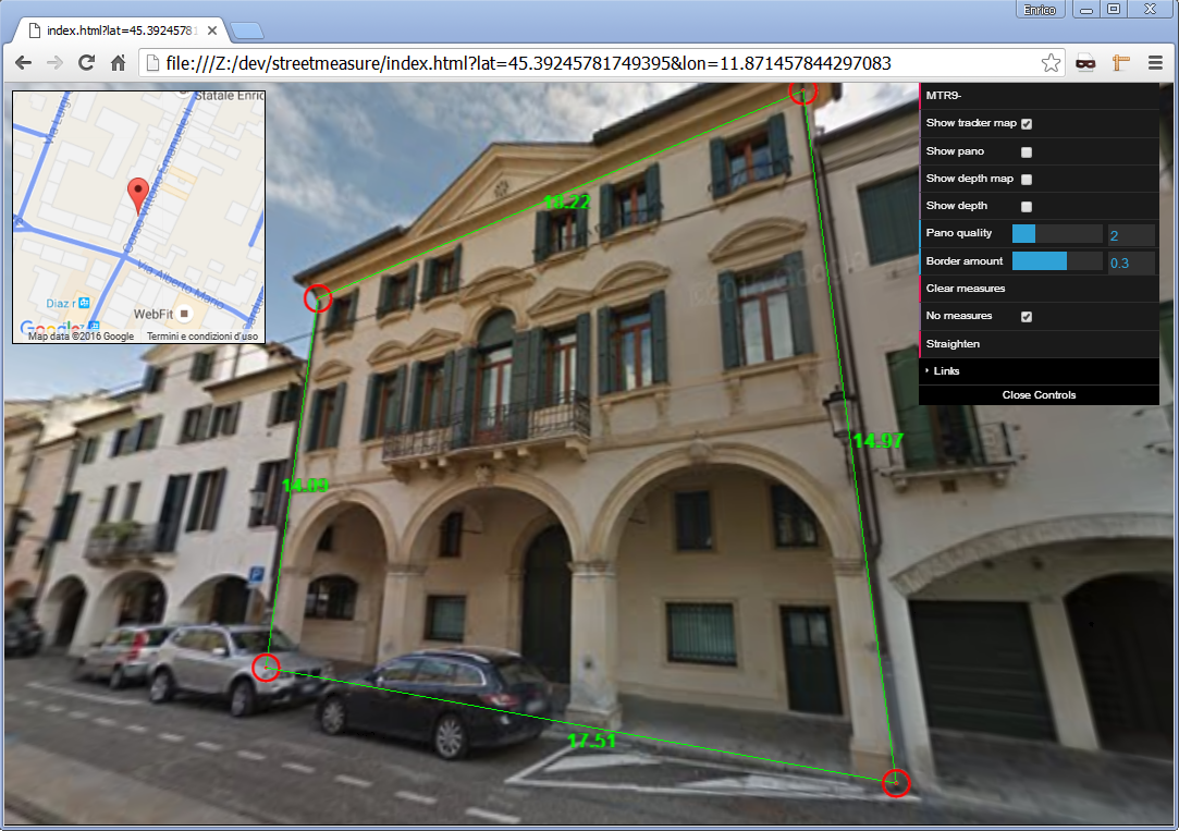[StreetMeasure](https://enricofer.github.io/streetmeasure/) [Street flow](https://callumprentice.github.io/apps/street_cloud_flow/index.html)
_2013_
MAPILLARY
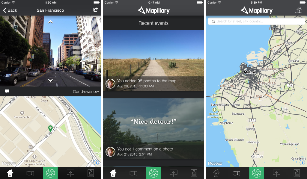crowdsourced mapping
licenza CC-BY-SA
in crescita esponenziale
[impegno sul fronte opensource](https://github.com/mapillary)
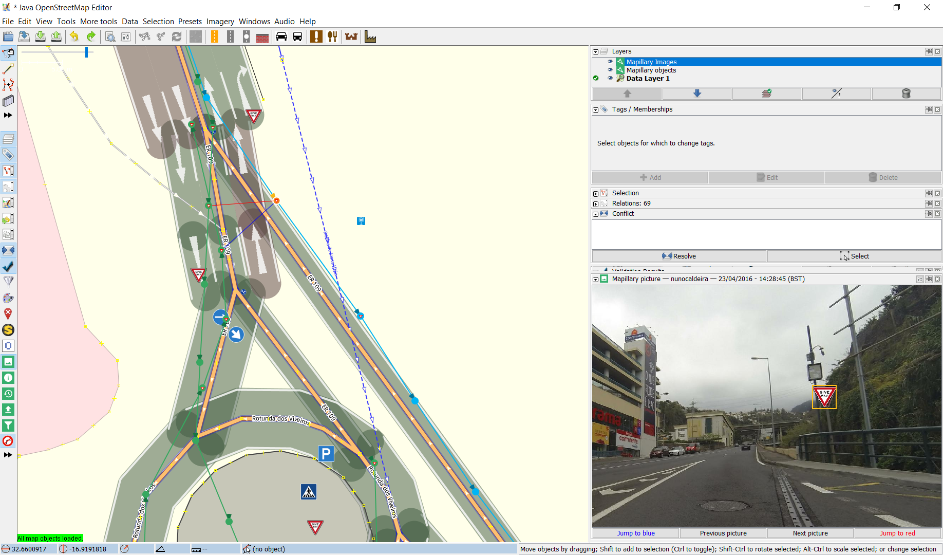_OSM_
Servizi a valore aggiunto
estrazione di informazioni
Mapillaryjs _REST API_
integrazione con QGIS
Per maggiore precisione,
riservatezza,
ed "uso derivativo",
ci sono pochi altri _SERVIZI PROFESSIONALI_
[globespotter](https://www.cyclomedia.com/en/service-and-support-for-users)

[imajbox](https://imajing.eu/mobile-mapping-solutions/mobile-mapping-system-imajbox/)

Nessun strumento open source....
[WIDESIGHT](https://github.com/enricofer/wide_sight)
Una applicazione web client-server
per l'organizzazione, l'archiviazione, la visualizzazione
e l'estrazione di informazioni da un dataset di immagini panoramiche
Utile per organizzazioni che operano sul territorio
Mappatura di spazi privati
Estrazione mirata di informazioni
_[widesight backend]_

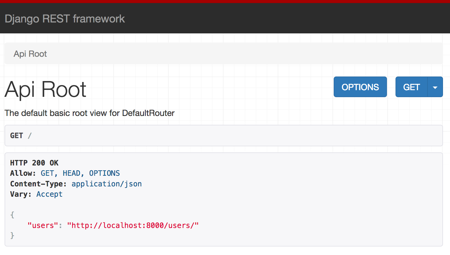_REST_
[sequences panoramas image_objects userkeys appkeys](https://app.swaggerhub.com/apis-docs/enricofer/Widesight/1.0.0)
_PIATTAFORMA PER POST PROCESSING_
_COMPUTER VISION_
RICOSTRUZIONI 3D STEREO
_[widesight frontend](https://github.com/enricofer/wide_sight)_
una web app modulare [dimostrativa](https://beato.duckdns.org:8443/static/)
per la visualizzazione di panorami in widesight
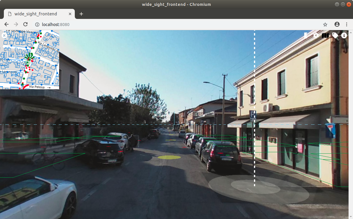
realizzata in javascript [THREEjs](https://threejs.org/)
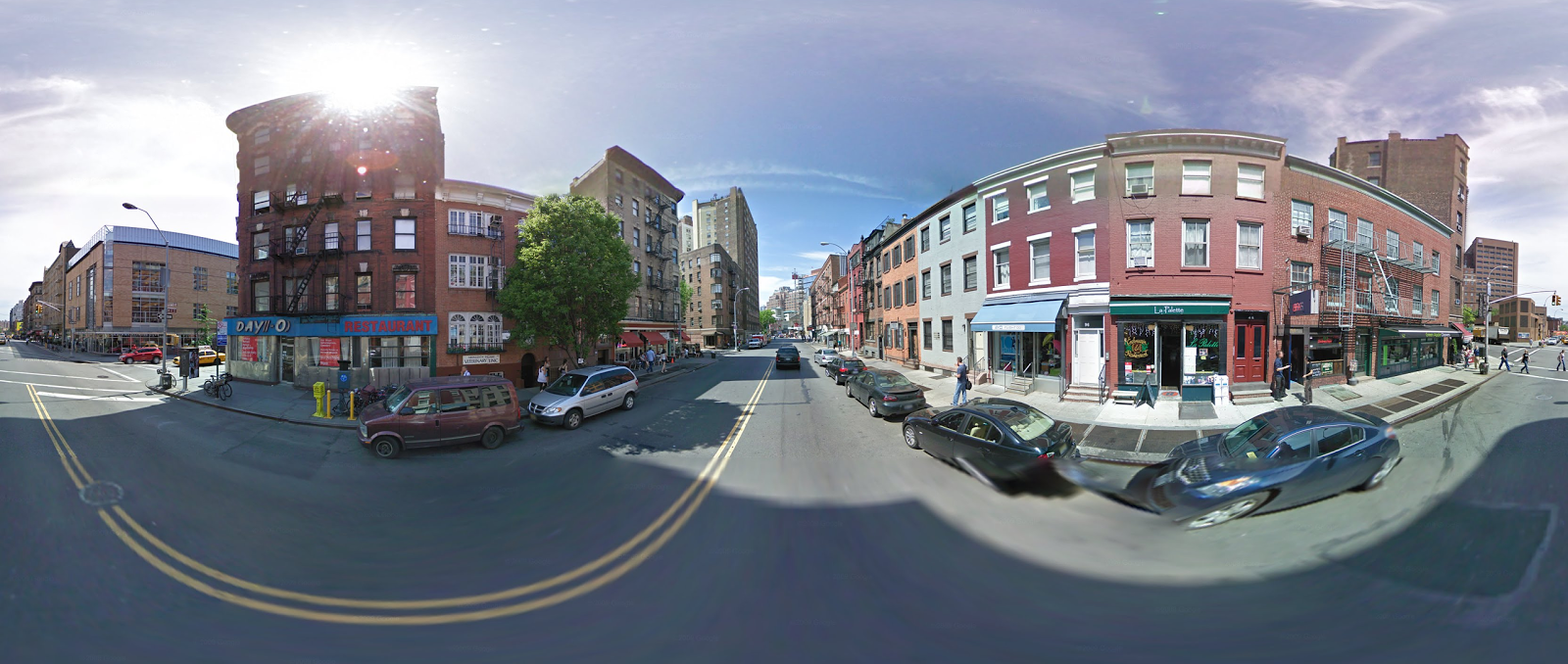Un immagine equirettangolare
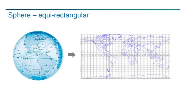_Può essere facilmente mappata su una sfera_
per simulare le condizioni di ripresa

[LIVE DEMO](https://beato.duckdns.org:8443/static/)
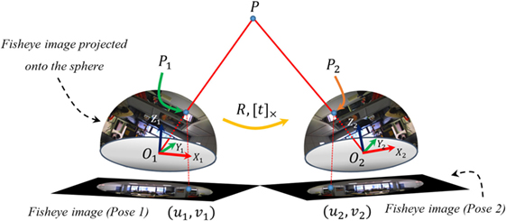
Per maggiore congruenza e precisione
è consigliabile posizionare ed orientare l'immagine
con strumenti di localizzazione GNSS
[widesight_utils](https://github.com/enricofer/wide_sight)
_fine_
ogni contributo è benvenuto
[github.com/enricofer/widesight](https://github.com/enricofer/wide_sight)
[github.com/enricofer/widesightfrontend](https://github.com/enricofer/wide_sight_frontend)
[github.com/enricofer/widesightutils](https://github.com/enricofer/wide_sight_utils)
[Enrico Ferreguti](enricofer@gmail.com)